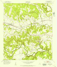
1947 Map of Nolanville
USGS Topo · Published 1953About this map
Nolanville serves as the central hub of this 1947 topographical record, situated along the Gulf Colorado and Santa Fe railroad line. The landscape is defined by the winding paths of the Leon River to the north and the Lampasas River to the south, with the distinctive Commanche Gap and Bald Face Mountain rising between the watersheds. This era shows a distributed rural community anchored by local institutions, including McDowell Ch and Wiltonville Sch.
Find a feature on this map
21 named features on this map. Tap any name to fly to it.
Don’t see what you’re looking for? This feature index may not catch every label — zoom into the map to look around manually.
Map Details
Editions of this 1947 Nolanville Map
This is the sole edition of this map. No revisions or reprints were ever made.
Other maps of this area

1885 · Taylor
USGS Topo · 1:125,000

1887 · Taylor
USGS Topo · 1:125,000

1892 · Temple
USGS Topo · 1:125,000

1893 · Georgetown
USGS Topo · 1:125,000

1894 · Gatesville
USGS Topo · 1:125,000

1894 · Taylor
USGS Topo · 1:125,000

1924 · Gatesville 4-d
USGS Topo · 1:48,000

1924 · Gatesville 4-a
USGS Topo · 1:48,000

1924 · Temple 3-C
USGS Topo · 1:48,000

1924 · Temple 3-B
USGS Topo · 1:48,000