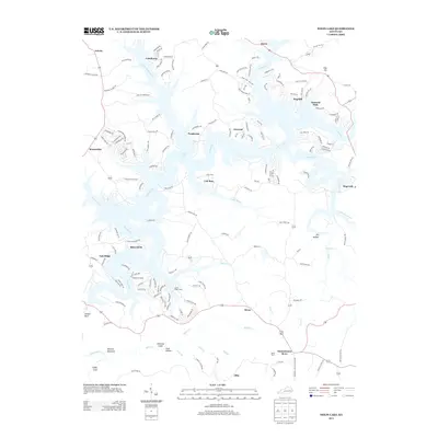
2013 Map of Nolin Lake
USGS Topo · Published 2013About this map
Nolin Lake dominates this central Kentucky landscape, where the winding Nolin River creates a complex system of wooded peninsulas and sheltered coves. The map captures the transition from lakeside communities like Moutardier and Iberia to the protected forests of Mammoth Cave National Park in the southeast. Cultural landmarks such as Demunbruns Store and Reeds Ferry reflect the area's rural social fabric, while geologic features like Dismal Rock, Whistle Mountain, and Chimney Stack punctuate the drainage basins of Bylew Cr and Brier Cr. The intricate road network serving local settlements like Cub Run and Hillview illustrates how residential growth has adapted to the jagged shoreline and the traditional farmland surrounding Straw and Ollie.
Find a feature on this map
158 named features on this map. Tap any name to fly to it.
Don’t see what you’re looking for? This feature index may not catch every label — zoom into the map to look around manually.
Map Details
Editions of this 2013 Nolin Lake Map
This is the sole edition of this map. No revisions or reprints were ever made.
Other maps of this area

1922 · Leitchfield
USGS Topo · 1:48,000

1922 · Brownsville
USGS Topo · 1:62,500

1922 · Mammoth Cave
USGS Topo · 1:62,500

1923 · Mammoth Cave
USGS Topo · 1:62,500

1923 · Brownsville
USGS Topo · 1:62,500

1925 · Cub Run
USGS Topo · 1:62,500

1925 · Leitchfield
USGS Topo · 1:62,500

1953 · Bee Spring
USGS Topo · 1:24,000

1954 · Evansville
USGS Topo · 1:250,000
1954 · Dickeys Mills
USGS Topo · 1:24,000