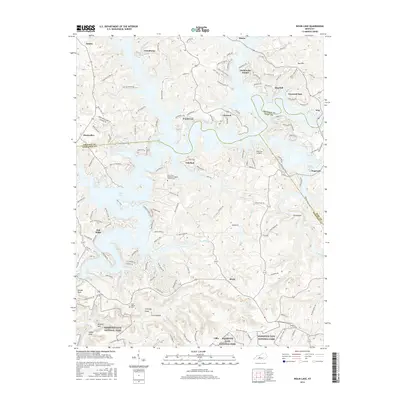
2016 Map of Nolin Lake
USGS Topo · Published 2016About this map
Mammoth Cave National Park anchors the southern boundary of this region, where the Nolin River enters a landscape defined by the winding arms of Nolin Lake. This mid-2010s survey shows a mosaic of lakeside residential developments and rural outposts spanning the borders of Edmonson, Grayson, and Hart counties. Communities like Moutardier, Cub Run, and Wax serve as focal points for the area's modern recreational identity, while older markers of local history remain visible. Genealogists and historians will find significant landmarks such as the Hill Grove Missionary Baptist Church Cem and Cove Hollow Cem. Distinctive geologic features like Dismal Rock, Whistle Mtn, and the Chimney Stack illustrate the complex topography of the Green River watershed, while the Lakeview Airport indicates the infrastructure supporting the lake's growth as a regional destination.
Find a feature on this map
149 named features on this map. Tap any name to fly to it.
Don’t see what you’re looking for? This feature index may not catch every label — zoom into the map to look around manually.
Map Details
Editions of this 2016 Nolin Lake Map
This is the sole edition of this map. No revisions or reprints were ever made.
Other maps of this area

1922 · Leitchfield
USGS Topo · 1:48,000

1922 · Brownsville
USGS Topo · 1:62,500

1922 · Mammoth Cave
USGS Topo · 1:62,500

1923 · Mammoth Cave
USGS Topo · 1:62,500

1923 · Brownsville
USGS Topo · 1:62,500

1925 · Cub Run
USGS Topo · 1:62,500

1925 · Leitchfield
USGS Topo · 1:62,500

1953 · Bee Spring
USGS Topo · 1:24,000

1954 · Evansville
USGS Topo · 1:250,000
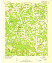
1954 · Dickeys Mills
USGS Topo · 1:24,000