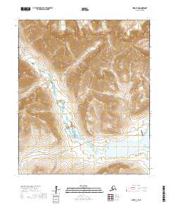
2017 Map of Nome D-1 NE
USGS Topo · Published 2017About this map
Seward Peninsula interior terrain defines this 2017 survey, where the Grand Central River and its numerous tributaries carve through the high elevations of the Kigluaik Mountains foothills. The Salmon Lake basin serves as a primary geographic anchor in the southeast, supported by the Salmon Lake Airport which provides critical bush access to this road-limited region. The Kougarok Road/Nome-Taylor Highway cuts a lone path across the landscape, following the river valley as it skirts the base of Copper Mtn. This corridor represents a vital link between the coast and the interior mining districts, evidenced by water bodies like Gold Run and Nugget Cr that carry names from the region's prospecting legacy. The drainage network is dense, featuring the N Fork Grand Central River and more obscure runs like Morning Call Cr and Tumit Cr.
Find a feature on this map
27 named features on this map. Tap any name to fly to it.
Don’t see what you’re looking for? This feature index may not catch every label — zoom into the map to look around manually.
Map Details
Editions of this 2017 Nome D-1 NE Map
This is the sole edition of this map. No revisions or reprints were ever made.
Other maps of this area

1950 · Bendeleben A-6
USGS Topo · 1:63,360

1950 · Nome
USGS Topo · 1:250,000

1950 · Teller
USGS Topo · 1:250,000

1950 · Bendeleben
USGS Topo · 1:250,000

1950 · Solomon
USGS Topo · 1:250,000

1950 · Solomon D-6
USGS Topo · 1:63,360

1950 · Nome D-1
USGS Topo · 1:63,360

1950 · Teller A-1
USGS Topo · 1:63,360

1951 · Bendeleben
USGS Topo · 1:250,000

1951 · Nome
USGS Topo · 1:250,000