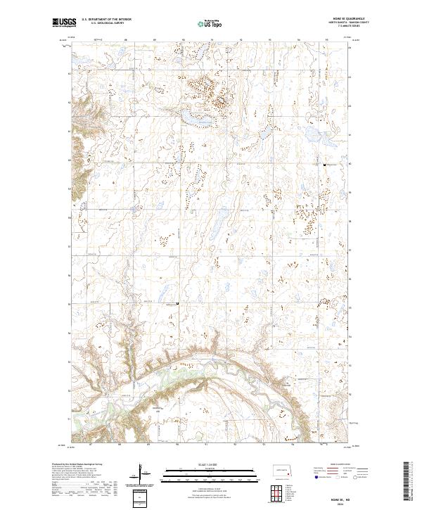
2024 Map of Nome SE
USGS Topo · Published 2024About this map
The Sheyenne River winds through the southern portion of this landscape, carving a distinct valley flanked by Scott Hill and Oestreicher Hill. This area of Ransom County is defined by a rigorous township and range grid, with gravel and paved roads like Co Hwy 136 and Valley Rd connecting remote farmsteads across the prairie. The topography reveals numerous small wetlands and glacial depressions typical of the region, including Brown Lake in the north-central section.
Find a feature on this map
29 named features on this map. Tap any name to fly to it.
Don’t see what you’re looking for? This feature index may not catch every label — zoom into the map to look around manually.
Map Details
Editions of this 2024 Nome SE Map
This is the sole edition of this map. No revisions or reprints were ever made.
Other maps of this area

1897 · Tower
USGS Topo · 1:125,000

1953 · Fargo
USGS Topo · 1:250,000

1956 · Fargo
USGS Topo · 1:250,000
1962 · Englevale
USGS Topo · 1:24,000

1962 · Lisbon
USGS Topo · 1:24,000

1962 · Elliott
USGS Topo · 1:24,000

1965 · Lucca
USGS Topo · 1:24,000

1967 · Ft. Ransom
USGS Topo · 1:24,000
1967 · Nome SE
USGS Topo · 1:24,000
1967 · Nome
USGS Topo · 1:24,000