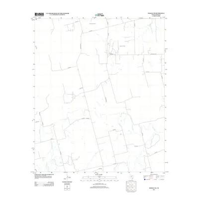
2012 Map of Noodle NE
USGS Topo · Published 2012About this map
The Bartlett Oil Field and Farnsworth Oil Field define the industrial character of this West Texas landscape, showing the ongoing role of petroleum extraction in Jones County. The terrain is structured by a grid of rural routes, including Ranch Road 126 and Golan Rd, which connect scattered ranching operations and oil leases. Hydrology is central to the area's layout, with the Clear Fork meandering across the southern portion of the quadrangle. This waterway is joined by several tributaries, notably Sweetwater Cr, Thompson Cr, and Noodle Cr, creating a drainage pattern that breaks the straight-line geometry of the local road network. The inclusion of Golf Corse Rd and numerous unnamed ranch roads suggests a landscape where traditional land use and modern infrastructure exist in tandem.
Find a feature on this map
31 named features on this map. Tap any name to fly to it.
Don’t see what you’re looking for? This feature index may not catch every label — zoom into the map to look around manually.
Map Details
Editions of this 2012 Noodle NE Map
This is the sole edition of this map. No revisions or reprints were ever made.
Other maps of this area
1891 · Anson
USGS Topo · 1:125,000
1893 · Roby
USGS Topo · 1:125,000
1893 · Anson
USGS Topo · 1:125,000
1954 · Big Spring
USGS Topo · 1:250,000
1954 · Abilene
USGS Topo · 1:250,000
1957 · Hawley
USGS Topo · 1:62,500
1957 · Noodle
USGS Topo · 1:62,500
1958 · Big Spring
USGS Topo · 1:250,000
1958 · Abilene
USGS Topo · 1:250,000
1965 · Neinda
USGS Topo · 1:24,000