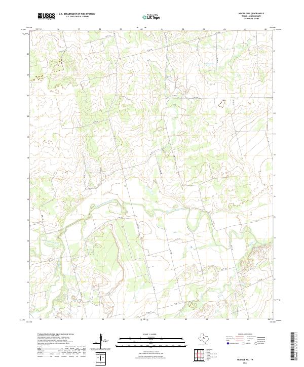
2022 Map of Noodle NE
USGS Topo · Published 2022About this map
The Clear Fork Brazos River winds through this Jones County landscape, creating a distinct hydrological corridor amid a grid of rural roads and agricultural tracts. This section of West Texas is defined by its drainage network, where Sweetwater Cr and Thompson Cr converge toward the primary river channel. The infrastructure is characterized by a high density of named county roads and farm-to-market routes like FM 126, which anchor the sparse residential and ranching patterns of the region. A notable local landmark includes the curiously spelled Golf Corse Rd, while Noodle Cr meanders through the southeastern portion of the quadrangle. The map captures the spatial organization of contemporary Texas ranchland, showing how modern transportation such as FM 2746 follows the natural contours and property lines established over generations of land use.
Find a feature on this map
28 named features on this map. Tap any name to fly to it.
Don’t see what you’re looking for? This feature index may not catch every label — zoom into the map to look around manually.
Map Details
Editions of this 2022 Noodle NE Map
This is the sole edition of this map. No revisions or reprints were ever made.
Other maps of this area

1891 · Anson
USGS Topo · 1:125,000

1893 · Roby
USGS Topo · 1:125,000

1893 · Anson
USGS Topo · 1:125,000

1954 · Big Spring
USGS Topo · 1:250,000

1954 · Abilene
USGS Topo · 1:250,000

1957 · Hawley
USGS Topo · 1:62,500

1957 · Noodle
USGS Topo · 1:62,500

1958 · Big Spring
USGS Topo · 1:250,000

1958 · Abilene
USGS Topo · 1:250,000
1965 · Neinda
USGS Topo · 1:24,000