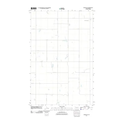
2011 Map of Noonan SE
USGS Topo · Published 2011About this map
Noonan Park Dam sits in the northeast corner of this remote section of Divide County, anchoring a landscape defined by the rigid geometry of the Public Land Survey System. The map reveals a sparsely populated agricultural region in the early 21st century, where the prairie is etched with a precise grid of gravel roads including 111th Ave NW and 95th St NW. Numerous small, ephemeral wetlands and prairie potholes are scattered across the terrain, illustrating the glacial heritage of the North Dakota plains. This 2011 edition provides a detailed perspective on the rural infrastructure and water management features, such as the network of section-line roads like 107th Ave NW, that support the region's ranching and farming operations.
Find a feature on this map
16 named features on this map. Tap any name to fly to it.
Don’t see what you’re looking for? This feature index may not catch every label — zoom into the map to look around manually.
Map Details
Editions of this 2011 Noonan SE Map
This is the sole edition of this map. No revisions or reprints were ever made.
Other maps of this area

1947 · Noonan
USGS Topo · 1:24,000

1949 · Columbus SW
USGS Topo · 1:24,000

1949 · Paulson
USGS Topo · 1:24,000

1949 · Atcoal
USGS Topo · 1:24,000

1949 · Noonan SW
USGS Topo · 1:24,000

1949 · Noonan SE
USGS Topo · 1:24,000

1949 · Noonan
USGS Topo · 1:24,000

1950 · Columbus
USGS Topo · 1:62,500

1950 · Noonan
USGS Topo · 1:62,500

1953 · Williston
USGS Topo · 1:250,000