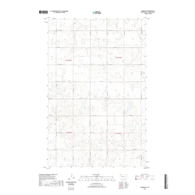
2020 Map of Noonan SE
USGS Topo · Published 2020About this map
Glacial prairie potholes and depressional wetlands dominate this portion of Divide County, North Dakota, as documented in 2020. The landscape is defined by the rigid grid of the Public Land Survey System, with sections clearly marked across townships t162n r96w, t162n r95w, t161n r96w, and t161n r95w. This section of the Missouri Plateau shows a terrain of countless small, unnamed water bodies and irregular contours that challenge the straight-line logic of the local road network.
Find a feature on this map
20 named features on this map. Tap any name to fly to it.
Don’t see what you’re looking for? This feature index may not catch every label — zoom into the map to look around manually.
Map Details
Editions of this 2020 Noonan SE Map
This is the sole edition of this map. No revisions or reprints were ever made.
Other maps of this area

1947 · Noonan
USGS Topo · 1:24,000

1949 · Columbus SW
USGS Topo · 1:24,000

1949 · Paulson
USGS Topo · 1:24,000

1949 · Atcoal
USGS Topo · 1:24,000

1949 · Noonan SW
USGS Topo · 1:24,000

1949 · Noonan SE
USGS Topo · 1:24,000

1949 · Noonan
USGS Topo · 1:24,000

1950 · Columbus
USGS Topo · 1:62,500

1950 · Noonan
USGS Topo · 1:62,500

1953 · Williston
USGS Topo · 1:250,000