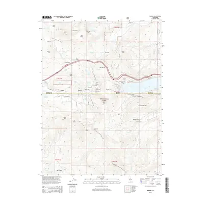
2015 Map of Norden
USGS Topo · Published 2015About this map
Donner Pass serves as the central focal point of this Sierra Nevada landscape, where historical transportation routes and high-altitude settlements congregate. The map documents the complex infrastructure surrounding Donner Lake, from the residential pockets at Donner Lake Village and Southside Highlands to the engineering landmarks of Donner Summit Bridge and McGlashan Point. The terrain is defined by its recreation and transit history, featuring the Sugar Bowl ski area and the winding path of the Pacific Crest National Scenic Trail as it traverses ridges like Schallenberger Ridge and peaks including Mt Judah. Small mountain communities and stops such as Norden, Eder, and The Cedars are situated among a high concentration of alpine lakes, including Lake Angela and Lake Van Norden, illustrating the region's enduring role as a critical gateway through the mountains.
Find a feature on this map
88 named features on this map. Tap any name to fly to it.
Don’t see what you’re looking for? This feature index may not catch every label — zoom into the map to look around manually.
Map Details
Editions of this 2015 Norden Map
This is the sole edition of this map. No revisions or reprints were ever made.
Other maps of this area

1891 · Truckee
USGS Topo · 1:125,000

1893 · Truckee
USGS Topo · 1:125,000

1895 · Truckee
USGS Topo · 1:125,000

1932 · Truckee
USGS Topo · 1:96,000

1940 · Truckee
USGS Topo · 1:125,000

1953 · Granite Chief
USGS Topo · 1:24,000
1953 · Royal Gorge
USGS Topo · 1:24,000

1953 · Granite Chief
USGS Topo · 1:62,500

1955 · Truckee
USGS Topo · 1:24,000
1955 · Tahoe City
USGS Topo · 1:24,000