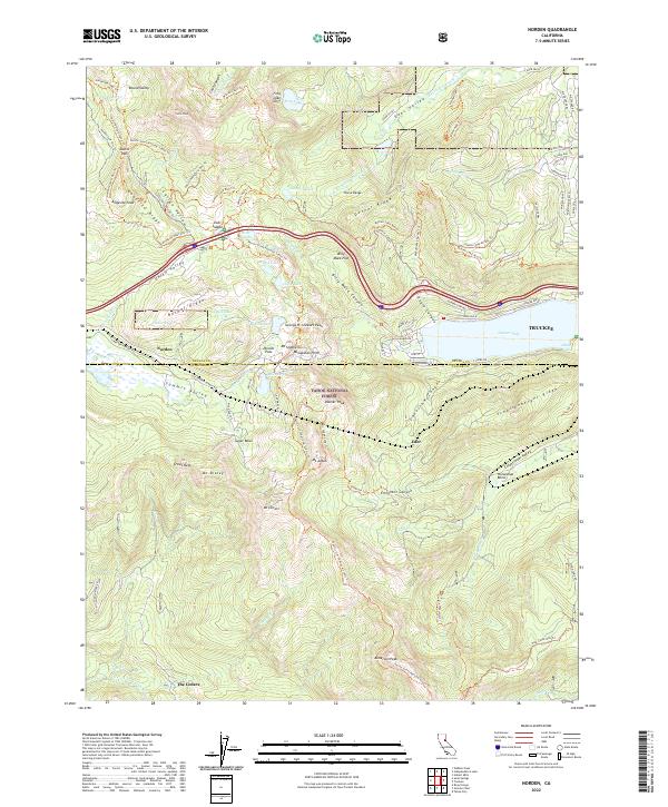
2022 Map of Norden
USGS Topo · Published 2022About this map
Donner Pass serves as the high-altitude centerpiece for this portion of the Sierra Nevada, marking a legendary corridor through Tahoe National Forest. The landscape is defined by its dramatic granite ridges and alpine basins, where the headwaters of the S Yuba River and the N Fork American River originate. High-elevation settlements such as Norden and the winter recreation hub of Sugar Bowl are shown alongside the historic alignment of the Old Donner Summit Rd, which traces the steep topography leading down toward Donner Lake.
Find a feature on this map
102 named features on this map. Tap any name to fly to it.
Don’t see what you’re looking for? This feature index may not catch every label — zoom into the map to look around manually.
Map Details
Editions of this 2022 Norden Map
This is the sole edition of this map. No revisions or reprints were ever made.
Other maps of this area

1891 · Truckee
USGS Topo · 1:125,000

1893 · Truckee
USGS Topo · 1:125,000

1895 · Truckee
USGS Topo · 1:125,000

1932 · Truckee
USGS Topo · 1:96,000

1940 · Truckee
USGS Topo · 1:125,000

1953 · Granite Chief
USGS Topo · 1:24,000
1953 · Royal Gorge
USGS Topo · 1:24,000

1953 · Granite Chief
USGS Topo · 1:62,500

1955 · Truckee
USGS Topo · 1:24,000
1955 · Tahoe City
USGS Topo · 1:24,000