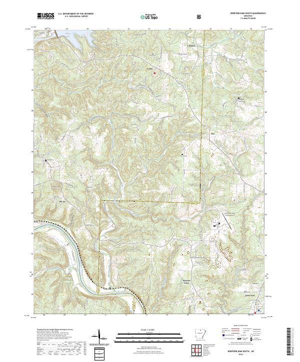
2024 Map of Norfork Dam South
USGS Topo · Published 2024About this map
The White River and the sprawling waters of Norfork Lake dominate this Ozark landscape, where the borders of Baxter, Izard, and Stone Counties meet. The rugged topography is defined by deep hollows like Hopewell Hollow and Schinette Hollow, which have long shaped the region's transport and settlement patterns. Established communities such as Jordan, Iuka, and Calico Rock are situated among these ridges, supported by a network of rural roads that follow the winding terrain.
Find a feature on this map
95 named features on this map. Tap any name to fly to it.
Don’t see what you’re looking for? This feature index may not catch every label — zoom into the map to look around manually.
Map Details
Editions of this 2024 Norfork Dam South Map
This is the sole edition of this map. No revisions or reprints were ever made.
Other maps of this area

1890 · Mountain Home
USGS Topo · 1:125,000

1891 · Mountain Home
USGS Topo · 1:125,000

1894 · Mountain Home
USGS Topo · 1:125,000

1945 · Harrison
USGS Topo · 1:250,000

1949 · Harrison
USGS Topo · 1:250,000

1954 · Harrison
USGS Topo · 1:250,000

1958 · Harrison
USGS Topo · 1:250,000

1964 · Harrison
USGS Topo · 1:250,000
1964 · Calico Rock
USGS Topo · 1:24,000
1964 · Pineville
USGS Topo · 1:24,000