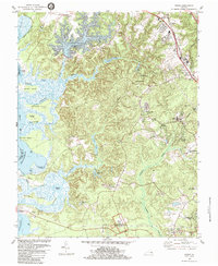
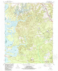
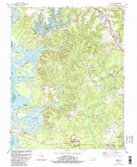
1984 Map of Norge
USGS Topo · Published 1984About this map
Green Spring Ruins stands as a significant historical anchor in the southern portion of this James City County landscape, situated within the Colonial National Historical Park. The map documents a period of suburban expansion and infrastructure development in the mid-1980s, evidenced by the growth around Norge and the emergence of residential areas like Windsor Forest and Jamestown Farms. The Chesapeake and Ohio railroad corridor serves as a primary axis for development, passing through Lightfoot and past the Smith Memorial Lib.
Find a feature on this map
60 named features on this map. Tap any name to fly to it.
Don’t see what you’re looking for? This feature index may not catch every label — zoom into the map to look around manually.
Map Details
Editions of this 1984 Norge Map
3 editions found
Other maps of this area

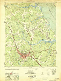
1906 · Williamsburg
USGS Topo · 1:62,500

1907 · Yorktown
USGS Topo · 1:62,500

1917 · Toano
USGS Topo · 1:62,500

1918 · Toano
USGS Topo · 1:62,500

1919 · Surry
USGS Topo · 1:62,500

1943 · Yorktown
USGS Topo · 1:62,500

1943 · Richmond
USGS Topo · 1:250,000

1949 · Richmond
USGS Topo · 1:250,000

1950 · Cobham Bay
USGS Topo · 1:24,000
1951 · Williamsburg
USGS Topo · 1:24,000