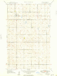
1948 Map of Norma
USGS Topo · Published 1948About this map
Norma serves as the primary rail settlement in this late 1940s landscape, situated along the tracks of the Minneapolis St Paul and Sault Ste Marie railroad. The map reveals a highly structured agricultural community organized around township blocks like Fairbanks and Sauk Prairie, where the placement of rural infrastructure tells the story of early North Dakota life. Education was localized and decentralized, as evidenced by the distribution of the Culver Sch, Sauk Prairie Sch, and the numerically designated School No 2. Civil life centered on the Town Hall in the heart of the Sauk Prairie district. The terrain is characterized by hundreds of small depressions and seasonal water bodies typical of the glaciated plains, with a lone Windmill noted in the southern township of Greenbush, highlighting the necessity of groundwater management for the surrounding farmsteads.
Find a feature on this map
14 named features on this map. Tap any name to fly to it.
Don’t see what you’re looking for? This feature index may not catch every label — zoom into the map to look around manually.
Map Details
Editions of this 1948 Norma Map
2 editions found
Other maps of this area

1947 · Tolley
USGS Topo · 1:62,500

1948 · Kenmare
USGS Topo · 1:24,000

1948 · Norma
USGS Topo · 1:24,000

1948 · Tolley
USGS Topo · 1:24,000

1948 · Donnybrook
USGS Topo · 1:24,000

1949 · Tolley SE
USGS Topo · 1:24,000

1949 · Bowbells SE
USGS Topo · 1:24,000

1949 · Coulee
USGS Topo · 1:24,000

1949 · Mouse River Park SW
USGS Topo · 1:24,000

1949 · Mouse River Park
USGS Topo · 1:24,000