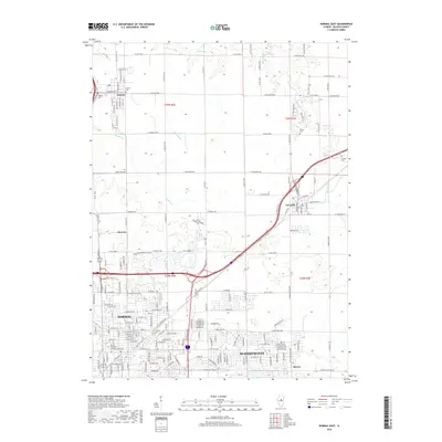
2018 Map of Normal East
USGS Topo · Published 2018About this map
Normal and Bloomington anchor the southern portion of this landscape, showing the dense residential grid and the sprawling campus of Illinois State University. This 2018 survey illustrates how the urban core transitions into a structured agricultural periphery, with smaller outlying settlements like Towanda, Hudson, and Kerrick connected by a network of rural routes. The drainage patterns of the central Illinois prairie are visible through the winding courses of Big Slough, Money Creek, and Sixmile Creek, which carve through the township sections toward larger reservoirs such as Lake Bloomington. For the local historian, the map preserves the location of several significant burial grounds, including Havens Cemetery, Hudson Cemetery, Bishop Cemetery, and Pennell Cemetery, which serve as quiet landmarks of the region's 19th-century pioneer settlement and family genealogy.
Find a feature on this map
61 named features on this map. Tap any name to fly to it.
Don’t see what you’re looking for? This feature index may not catch every label — zoom into the map to look around manually.
Map Details
Editions of this 2018 Normal East Map
This is the sole edition of this map. No revisions or reprints were ever made.
Other maps of this area

1926 · Normal
USGS Topo · 1:62,500

1927 · Danvers
USGS Topo · 1:62,500

1930 · Danvers
USGS Topo · 1:62,500

1930 · Normal
USGS Topo · 1:62,500

1949 · Mc Lean
USGS Topo · 1:62,500

1951 · McLean
USGS Topo · 1:62,500

1951 · Le Roy
USGS Topo · 1:62,500

1958 · Peoria
USGS Topo · 1:250,000

1961 · Peoria
USGS Topo · 1:250,000

1963 · Peoria
USGS Topo · 1:250,000