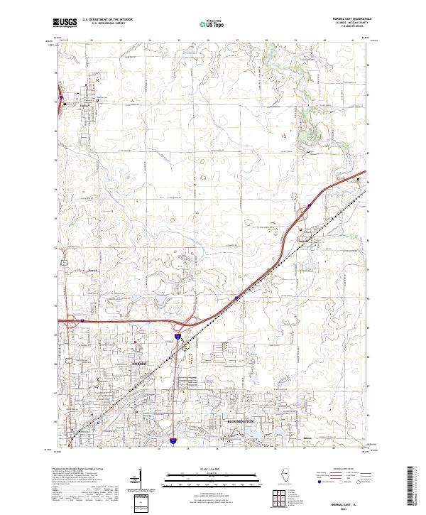
2024 Map of Normal East
USGS Topo · Published 2024About this map
Normal and Bloomington anchor the southern portion of this landscape, showing the dense residential grid and institutional footprint of Illinois State University. Moving north and east, the urban core gives way to the agricultural drainage systems of Big Slough and Money Creek, revealing how modern infrastructure has adapted to the natural hydrology of central Illinois. The map documents the persistent legacy of early settlement through its rural burial grounds, including Hudson Cem and the isolated Pennell Cem. Historical transportation corridors are clearly defined, from the path of Old Rte 66 through Towanda to the secondary rail and road connections at Kerrick and Barnes. The layout of the Ironwood Country Club Dr area illustrates the northward expansion of the twin cities into formerly open farmland.
Find a feature on this map
39 named features on this map. Tap any name to fly to it.
Don’t see what you’re looking for? This feature index may not catch every label — zoom into the map to look around manually.
Map Details
Editions of this 2024 Normal East Map
This is the sole edition of this map. No revisions or reprints were ever made.
Other maps of this area

1926 · Normal
USGS Topo · 1:62,500

1927 · Danvers
USGS Topo · 1:62,500

1930 · Danvers
USGS Topo · 1:62,500

1930 · Normal
USGS Topo · 1:62,500

1949 · Mc Lean
USGS Topo · 1:62,500

1951 · McLean
USGS Topo · 1:62,500

1951 · Le Roy
USGS Topo · 1:62,500

1958 · Peoria
USGS Topo · 1:250,000

1961 · Peoria
USGS Topo · 1:250,000

1963 · Peoria
USGS Topo · 1:250,000