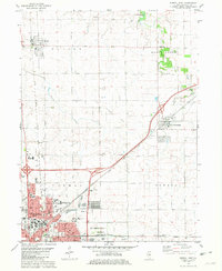
1981 Map of Normal East
USGS Topo · Published 1981About this map
Normal and Bloomington anchor this detailed study of the suburban and rural landscape in central Illinois. The northern edge of the urban area is defined by the sprawling campus of Illinois State University and the specialized grounds of the Soldiers and Sailors State Childrens Home. Beyond the city limits, the terrain transitions into a patchwork of agricultural lands and natural drainage systems, including the headwaters of Sugar Creek and the meandering path of Money Creek.
Find a feature on this map
37 named features on this map. Tap any name to fly to it.
Don’t see what you’re looking for? This feature index may not catch every label — zoom into the map to look around manually.
Map Details
Editions of this 1981 Normal East Map
This is the sole edition of this map. No revisions or reprints were ever made.
Other maps of this area

1926 · Normal
USGS Topo · 1:62,500

1927 · Danvers
USGS Topo · 1:62,500

1930 · Danvers
USGS Topo · 1:62,500

1930 · Normal
USGS Topo · 1:62,500

1949 · Mc Lean
USGS Topo · 1:62,500

1951 · McLean
USGS Topo · 1:62,500

1951 · Le Roy
USGS Topo · 1:62,500

1958 · Peoria
USGS Topo · 1:250,000

1961 · Peoria
USGS Topo · 1:250,000

1963 · Peoria
USGS Topo · 1:250,000