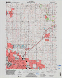
1998 Map of Normal East
USGS Topo · Published 2000About this map
Normal and Bloomington anchor this late-twentieth-century landscape, where the urban expansion of McLean County meets the fertile plains of the Illinois corn belt. The map documents the significant footprint of Illinois State University and institutional landmarks like the Soldiers and Sailors State Childrens Home, contrasting with the surrounding rural townships of Hudson, Money Creek, and Towanda. Transport infrastructure is prominent, featuring major interchanges and the sprawling Gas Storage Area situated between the primary settlements.
Find a feature on this map
41 named features on this map. Tap any name to fly to it.
Don’t see what you’re looking for? This feature index may not catch every label — zoom into the map to look around manually.
Map Details
Editions of this 1998 Normal East Map
This is the sole edition of this map. No revisions or reprints were ever made.
Other maps of this area

1926 · Normal
USGS Topo · 1:62,500

1927 · Danvers
USGS Topo · 1:62,500

1930 · Danvers
USGS Topo · 1:62,500

1930 · Normal
USGS Topo · 1:62,500

1949 · Mc Lean
USGS Topo · 1:62,500

1951 · McLean
USGS Topo · 1:62,500

1951 · Le Roy
USGS Topo · 1:62,500

1958 · Peoria
USGS Topo · 1:250,000

1961 · Peoria
USGS Topo · 1:250,000

1963 · Peoria
USGS Topo · 1:250,000