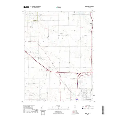
2018 Map of Normal West
USGS Topo · Published 2018About this map
McLean County farmland meets the expanding northern reaches of Normal and Bloomington in this 2018 survey. The landscape is a study in transition, where the geometric precision of the township and range system—defined by roads like E 1800 North Rd and N 1000 East Rd—encounters the irregular drainages of Denman Creek and Kings Mill Creek. Educational infrastructure is prominent near the urban fringe at Heartland Community College, while the surrounding countryside preserves its pioneer roots through scattered family burial grounds. Genealogists and local historians will find several well-marked sites including Denman Cem, Troyer Cem, and Ropp Cem. The northern portion of the map is dominated by the reservoir waters of Evergreen Lake and the village of Hudson, contrasting with the western agricultural community of Carlock.
Find a feature on this map
94 named features on this map. Tap any name to fly to it.
Don’t see what you’re looking for? This feature index may not catch every label — zoom into the map to look around manually.
Map Details
Editions of this 2018 Normal West Map
This is the sole edition of this map. No revisions or reprints were ever made.
Other maps of this area

1926 · Normal
USGS Topo · 1:62,500

1927 · Danvers
USGS Topo · 1:62,500

1930 · Danvers
USGS Topo · 1:62,500

1930 · Normal
USGS Topo · 1:62,500

1949 · Mc Lean
USGS Topo · 1:62,500

1951 · McLean
USGS Topo · 1:62,500

1951 · Le Roy
USGS Topo · 1:62,500

1958 · Peoria
USGS Topo · 1:250,000

1961 · Peoria
USGS Topo · 1:250,000

1963 · Peoria
USGS Topo · 1:250,000