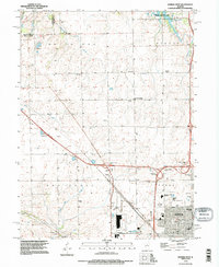
1995 Map of Normal West
USGS Topo · Published 1996About this map
Normal expands into the surrounding townships of Dry Grove, Hudson, and White Oak during the mid-1990s. This survey highlights the institutional presence of Illinois State University and several educational landmarks such as Normal Community West High Sch and Oakdale Sch. While the urban core of Normal fills the southeast, the remaining landscape preserves a network of family-named cemeteries and rural settlements like Yuton and Denman. Significant recreational and water management features occupy the northern reaches, including Comlara County Park and the sprawling waters of Evergreen Lake. The transition from agrarian land to suburban development is evident through the complex of highway interchanges and the presence of the State University Farm, reflecting the region's educational and agricultural dual identity.
Find a feature on this map
49 named features on this map. Tap any name to fly to it.
Don’t see what you’re looking for? This feature index may not catch every label — zoom into the map to look around manually.
Map Details
Editions of this 1995 Normal West Map
This is the sole edition of this map. No revisions or reprints were ever made.
Other maps of this area

1926 · Normal
USGS Topo · 1:62,500

1927 · Danvers
USGS Topo · 1:62,500

1930 · Danvers
USGS Topo · 1:62,500

1930 · Normal
USGS Topo · 1:62,500

1949 · Mc Lean
USGS Topo · 1:62,500

1951 · McLean
USGS Topo · 1:62,500

1951 · Le Roy
USGS Topo · 1:62,500

1958 · Peoria
USGS Topo · 1:250,000

1961 · Peoria
USGS Topo · 1:250,000

1963 · Peoria
USGS Topo · 1:250,000