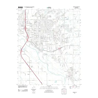
2012 Map of Norman
USGS Topo · Published 2012About this map
The Canadian River and its accompanying floodplains dominate the western landscape of this region, providing a natural boundary for the growing communities of Goldsby and Noble. This 2012 survey illustrates the dense suburban grid of Norman extending toward Hall Park, punctuated by several active petroleum sites including the Norman Townsite Oil Field and the East Norman Oil Field. These fields reflect the enduring importance of the oil industry to the local economy alongside major transportation and aviation hubs like the University of Oklahoma Westheimer Airport.
Find a feature on this map
29 named features on this map. Tap any name to fly to it.
Don’t see what you’re looking for? This feature index may not catch every label — zoom into the map to look around manually.
Map Details
Editions of this 2012 Norman Map
This is the sole edition of this map. No revisions or reprints were ever made.
Other maps of this area

1892 · Moore
USGS Topo · 1:62,500

1893 · Norman
USGS Topo · 1:62,500

1893 · Oklahoma City
USGS Topo · 1:62,500

1898 · Purcell
USGS Topo · 1:125,000

1904 · Chickasha
USGS Topo · 1:125,000

1925 · Norman NO 2
USGS Topo · 1:24,000

1934 · Moore
USGS Topo · 1:62,500

1936 · Norman
USGS Topo · 1:62,500

1938 · Moore
USGS Topo · 1:62,500

1954 · Oklahoma City
USGS Topo · 1:250,000