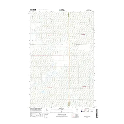
2016 Map of Norman Lake
USGS Topo · Published 2016About this map
Norman Lake and the winding course of the Tamarac River anchor this remote wetland landscape along the boundary of Beltrami and Koochiching counties. The terrain is defined by a dense network of hydrologic features, including the Little Tamarac River and the Lost River, which underscore the region's importance to Minnesota's northern watershed. The human footprint is marked primarily by rural infrastructure and land management routes like Forrest Road 96 and Co Rd 40. Specific local landmarks such as Steel Bridge Rd Ne and Rice Paddy Rd Ne suggest the intersection of transport and specialized agriculture or natural resource access. This 2016 survey captures the precise township and range divisions, such as t154n r30w, showing how these survey lines overlay a complex system of marshes and river bends.
Find a feature on this map
14 named features on this map. Tap any name to fly to it.
Don’t see what you’re looking for? This feature index may not catch every label — zoom into the map to look around manually.
Map Details
Editions of this 2016 Norman Lake Map
This is the sole edition of this map. No revisions or reprints were ever made.
Other maps of this area
1919 · Fox
USGS Topo · 1:62,500
1919 · Norden
USGS Topo · 1:62,500
1919 · Knutson
USGS Topo · 1:62,500

1954 · Roseau
USGS Topo · 1:250,000

1957 · Roseau
USGS Topo · 1:250,000

1958 · Roseau
USGS Topo · 1:250,000
1973 · Ludlow Lookout Tower
USGS Topo · 1:24,000
1973 · Norman Lake SE
USGS Topo · 1:24,000
1973 · Norman Lake
USGS Topo · 1:24,000
1973 · Wayland SW
USGS Topo · 1:24,000