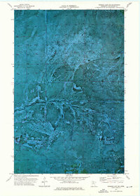
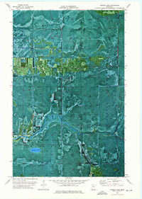
1973 Map of Norman Lake NE
USGS Topo · Published 1976About this map
Pine Island State Forest and the eastern portion of the Red Lake Indian Reservation define this remote northern Minnesota landscape as it appeared in the early 1970s. This orthophotomap combines traditional topographic data with aerial photography, revealing the intricate water systems of the Sturgeon River, Tamarac River, and Lost River. The terrain is characterized by expansive wetlands and low-lying woods, where seasonal access is maintained through a network of specialized routes like the Winter Trail and the Lost River Trail. The imagery captures the specific texture of the muskeg and forest cover, providing researchers with a clear view of the Red Lake Indian Reservation Boundary as it cuts through this sparsely populated territory on the Koochiching County line.
Find a feature on this map
11 named features on this map. Tap any name to fly to it.
Don’t see what you’re looking for? This feature index may not catch every label — zoom into the map to look around manually.
Map Details
Editions of this 1973 Norman Lake NE Map
This is the sole edition of this map. No revisions or reprints were ever made.
Other maps of this area

1919 · Lundgren
USGS Topo · 1:62,500

1919 · Norden
USGS Topo · 1:62,500

1919 · I
USGS Topo · 1:62,500

1954 · Roseau
USGS Topo · 1:250,000

1957 · Roseau
USGS Topo · 1:250,000

1958 · Roseau
USGS Topo · 1:250,000
1973 · Ridge SW
USGS Topo · 1:24,000
1973 · Ridge NW
USGS Topo · 1:24,000
1973 · Norman Lake SE
USGS Topo · 1:24,000
1973 · Norman Lake
USGS Topo · 1:24,000