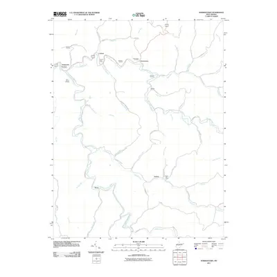
2011 Map of Normantown
USGS Topo · Published 2011About this map
Normantown and its neighboring hamlets follow the winding path of Left Fork Steer Creek and Right Fork Steer Creek in this central West Virginia topography. The map documents a landscape defined by sharp ridges and deep runs, where small post offices like those at Stumptown and Lockney served as vital community hubs. The drainage patterns of Crooked Fork and Owen Run dictate the placement of roads and homesteads, illustrating the traditional Appalachian reliance on valley floors for transportation and settlement. Genealogists will find significant value in the distribution of family-named burial grounds, including the Snakeroot Cemetery, Meadows Cemetery, and Elihu-Stump Cemetery. Elevated terrain such as Lads Run Ridge and Perkins Hill overlook the narrow corridors where local life has centered for generations.
Find a feature on this map
75 named features on this map. Tap any name to fly to it.
Don’t see what you’re looking for? This feature index may not catch every label — zoom into the map to look around manually.
Map Details
Editions of this 2011 Normantown Map
This is the sole edition of this map. No revisions or reprints were ever made.
Other maps of this area

1893 · Sutton
USGS Topo · 1:125,000

1906 · Glenville
USGS Topo · 1:62,500

1906 · Otter
USGS Topo · 1:62,500

1907 · Otter
USGS Topo · 1:62,500

1907 · Arnoldsburg
USGS Topo · 1:62,500

1908 · Gassaway
USGS Topo · 1:48,000

1910 · Gassaway
USGS Topo · 1:62,500

1925 · Glenville
USGS Topo · 1:62,500

1925 · Arnoldsburg
USGS Topo · 1:62,500

1927 · Arnoldsburg
USGS Topo · 1:62,500