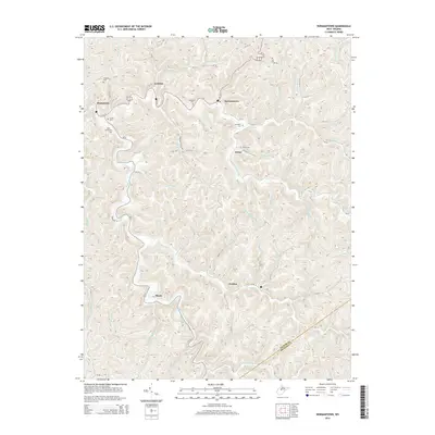
2014 Map of Normantown
USGS Topo · Published 2014About this map
The winding waters of Left Fork Steer Creek and Right Fork Steer Creek define this rural landscape on the border of Gilmer and Braxton Counties. Small crossroad communities such as Normantown and Stumptown anchor the northern reaches of the map along Us-119, while the settlement of Shock marks a sharp bend in the creek further south. The region's topography is characterized by deep hollows and narrow ridges, each named for the families or natural features that defined early settlement, such as Owen Run, Mikes Run, and Wolfpen Run. For those researching Appalachian family history, numerous small burial grounds are meticulously documented, including Snakeroot Cem, Elihu Stump Cem, and Meadows Cem, which reflect the localized, kin-based social structure typical of this part of West Virginia.
Find a feature on this map
75 named features on this map. Tap any name to fly to it.
Don’t see what you’re looking for? This feature index may not catch every label — zoom into the map to look around manually.
Map Details
Editions of this 2014 Normantown Map
This is the sole edition of this map. No revisions or reprints were ever made.
Other maps of this area

1893 · Sutton
USGS Topo · 1:125,000

1906 · Glenville
USGS Topo · 1:62,500

1906 · Otter
USGS Topo · 1:62,500

1907 · Otter
USGS Topo · 1:62,500

1907 · Arnoldsburg
USGS Topo · 1:62,500

1908 · Gassaway
USGS Topo · 1:48,000

1910 · Gassaway
USGS Topo · 1:62,500

1925 · Glenville
USGS Topo · 1:62,500

1925 · Arnoldsburg
USGS Topo · 1:62,500

1927 · Arnoldsburg
USGS Topo · 1:62,500