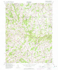
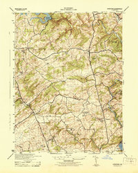
1957 Map of Norrisville
USGS Topo · Published 1975About this map
Deer Creek carves a winding path through this rolling landscape along the Dixon Line, where the border between Maryland and Pennsylvania is defined by historical markers and rural crossroads. Small, industrious settlements like Gorsuch Mills and Ivory Mill anchor the local economy around the waterways, while the presence of scattered country churches such as New Bethel Ch and Ayers Chapel indicates the central role of community parishes in the mid-20th century. The intricate network of local thoroughfares, including West Liberty Road and Norrisville Road, links family farms to larger hubs like Stewartstown and Norrisville. Many of these names—Shane, Shawsville, and Stahlersville—reflect the deep genealogical roots of the region. Cultural features like the Jolly Acres Summer Camp and several well-established burying grounds, such as Pine Grove Memorial Cem, offer a detailed look at the social and commemorative landscape before significant modern development altered these rural corridors.
Find a feature on this map
86 named features on this map. Tap any name to fly to it.
Don’t see what you’re looking for? This feature index may not catch every label — zoom into the map to look around manually.
Map Details
Editions of this 1957 Norrisville Map
4 editions found
Other maps of this area

1900 · Parkton
USGS Topo · 1:62,500

1901 · Belair
USGS Topo · 1:62,500

1902 · Parkton
USGS Topo · 1:62,500

1908 · York
USGS Topo · 1:62,500

1910 · York
USGS Topo · 1:62,500

1912 · Mc Calls Ferry
USGS Topo · 1:62,500

1942 · Bel Air
USGS Topo · 1:62,500

1943 · Mc Calls Ferry
USGS Topo · 1:62,500

1944 · New Freedom
USGS Topo · 1:31,680
1944 · Hereford
USGS Topo · 1:31,680