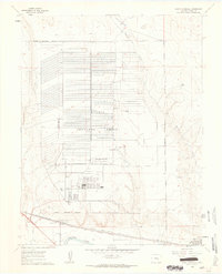
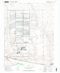
1960 Map of North Avondale
USGS Topo · Published 1963About this map
The Pueblo Ordnance Depot dominates this portion of the Colorado landscape, its vast grid of structures and access roads filling a large portion of the military reservation. The installation is flanked by several seasonal watercourses including Haynes Creek, Chico Creek, and Boone Creek, which drain south toward the main valley. Along the southern edge, the Arkansas River serves as a primary geographic corridor, paralleled by the Colorado Canal and two major rail lines: the Atchison Topeka and Santa Fe and the Missouri Pacific.
Find a feature on this map
17 named features on this map. Tap any name to fly to it.
Don’t see what you’re looking for? This feature index may not catch every label — zoom into the map to look around manually.
Map Details
Editions of this 1960 North Avondale Map
5 editions found
Other maps of this area

1891 · Nepesta
USGS Topo · 1:125,000

1893 · Nepesta
USGS Topo · 1:125,000

1904 · Nepesta
USGS Topo · 1:125,000

1954 · Pueblo
USGS Topo · 1:250,000

1957 · Pueblo
USGS Topo · 1:250,000

1958 · Pueblo
USGS Topo · 1:250,000

1959 · Highlands Church
USGS Topo · 1:24,000

1959 · North Avondale NE
USGS Topo · 1:24,000
1960 · Nepesta
USGS Topo · 1:24,000
1960 · Boone Hill
USGS Topo · 1:24,000