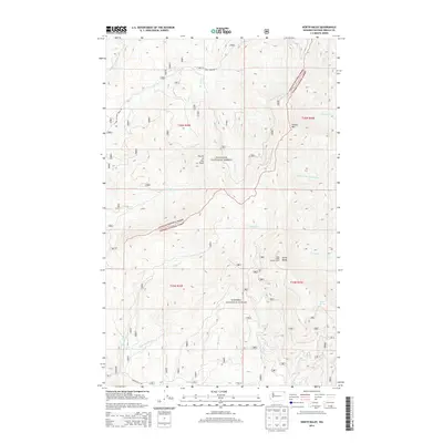
2014 Map of North Baldy
USGS Topo · Published 2014About this map
North Baldy dominates the eastern boundary of this terrain, where the North Baldy Lookout Tower stands as a sentinel over the vast forested tracts of the Colville National Forest and Kanisku National Forest. The landscape is defined by a complex drainage network that includes the Middle Br Le Clerc Cr and Middle Cr, which flow through deep mountain valleys. This 2014 survey reveals the high-altitude character of the Selkirk region, featuring prominent heights like Hungry Mtn and Fourth of July Peak. The network of forestry roads, such as E Fork Le Clerc Creek Rd and Squaw Valley Rd, provides the primary access to these remote reaches, while specialized features like Grouse Springs and Wanless Cr highlight the vital water sources in this high-country wilderness.
Find a feature on this map
29 named features on this map. Tap any name to fly to it.
Don’t see what you’re looking for? This feature index may not catch every label — zoom into the map to look around manually.
Map Details
Editions of this 2014 North Baldy Map
This is the sole edition of this map. No revisions or reprints were ever made.
Other maps of this area

1934 · Metaline
USGS Topo · 1:125,000

1936 · Newport
USGS Topo · 1:96,000

1942 · Metaline
USGS Topo · 1:125,000

1942 · Newport
USGS Topo · 1:125,000

1958 · Sandpoint
USGS Topo · 1:250,000

1963 · Sandpoint
USGS Topo · 1:250,000

1967 · Scotchman Lake
USGS Topo · 1:24,000

1967 · Monumental Mtn.
USGS Topo · 1:24,000
1967 · Orwig Hump
USGS Topo · 1:24,000
1967 · North Baldy
USGS Topo · 1:24,000