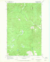
1967 Map of Orwig Hump
USGS Topo · Published 1971About this map
Kaniksu National Forest straddles the boundary between Washington and Idaho in this late 1960s survey, dominated by a network of drainage basins and high summits. The landscape is defined by the convergence of several major watercourses, including the North Fork Granite Creek and South Fork Granite Creek, which carve deep valleys through the high country. High-altitude wetlands and basins like Sema Meadows, Mountain Meadows, and Packer Meadows provide distinct ecological pockets among the steep slopes of Orwig Hump and Diamond Peak. Human activity is primarily represented by a network of wilderness routes, notably the Tillicum Jeep Trail and various unnamed pack trails. A lone Lookout Tower on Indian Mtn overlooks the vast drainage systems of Indian Creek and Athol Creek, highlighting the region's importance for forest management and fire observation during this era.
Find a feature on this map
34 named features on this map. Tap any name to fly to it.
Don’t see what you’re looking for? This feature index may not catch every label — zoom into the map to look around manually.
Map Details
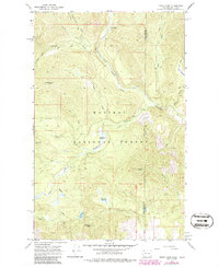
Editions of this 1967 Orwig Hump Map
2 editions found
Other maps of this area

1911 · Priest Lake
USGS Topo · 1:250,000

1913 · Priest Lake
USGS Topo · 1:250,000

1934 · Metaline
USGS Topo · 1:125,000

1942 · Metaline
USGS Topo · 1:125,000

1958 · Sandpoint
USGS Topo · 1:250,000

1963 · Sandpoint
USGS Topo · 1:250,000

1967 · Priest Lake NW
USGS Topo · 1:24,000

1967 · Monumental Mtn.
USGS Topo · 1:24,000

1967 · Helmer Mtn
USGS Topo · 1:24,000

1967 · Pass Creek
USGS Topo · 1:24,000