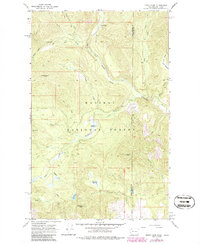
1967 Map of Orwig Hump
USGS Topo · Published 1986About this map
Kaniksu National Forest straddles the state line between Washington and Idaho in this 1960s topographic study, showcasing a remote landscape defined by the drainage of North Fork Granite Creek and its many tributaries. The area is marked by significant topographical landmarks such as Orwig Hump and Diamond Peak, along with the Lookout Tower Indian Mtn which served as a critical vantage point for fire detection in the mid-century forest service era.
Find a feature on this map
30 named features on this map. Tap any name to fly to it.
Don’t see what you’re looking for? This feature index may not catch every label — zoom into the map to look around manually.
Map Details
Editions of this 1967 Orwig Hump Map
2 editions found
Other maps of this area

1911 · Priest Lake
USGS Topo · 1:250,000

1913 · Priest Lake
USGS Topo · 1:250,000

1934 · Metaline
USGS Topo · 1:125,000

1942 · Metaline
USGS Topo · 1:125,000

1958 · Sandpoint
USGS Topo · 1:250,000

1963 · Sandpoint
USGS Topo · 1:250,000

1967 · Priest Lake NW
USGS Topo · 1:24,000

1967 · Monumental Mtn.
USGS Topo · 1:24,000

1967 · Helmer Mtn
USGS Topo · 1:24,000

1967 · Pass Creek
USGS Topo · 1:24,000