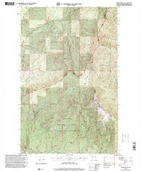
1996 Map of North Baldy
USGS Topo · Published 2000About this map
North Baldy dominates the landscape of this Pend Oreille County survey, marking a high point in the high-elevation divide between the Selkirk Mountains and the Priest River drainage. This terrain is defined by the complex borders of the Colville National Forest and Kaniksu National Forest, where land management responsibilities intersect across the ridgelines. Deep drainage networks like the Middle Fork Mill Creek and Pepin West Branch Priest River carve out the topography, indicating a landscape heavily utilized for forestry and watershed protection during the late twentieth century.
Find a feature on this map
22 named features on this map. Tap any name to fly to it.
Don’t see what you’re looking for? This feature index may not catch every label — zoom into the map to look around manually.
Map Details
Editions of this 1996 North Baldy Map
This is the sole edition of this map. No revisions or reprints were ever made.
Other maps of this area

1934 · Metaline
USGS Topo · 1:125,000

1936 · Newport
USGS Topo · 1:96,000

1942 · Metaline
USGS Topo · 1:125,000

1942 · Newport
USGS Topo · 1:125,000

1958 · Sandpoint
USGS Topo · 1:250,000

1963 · Sandpoint
USGS Topo · 1:250,000

1967 · Scotchman Lake
USGS Topo · 1:24,000

1967 · Monumental Mtn.
USGS Topo · 1:24,000
1967 · Orwig Hump
USGS Topo · 1:24,000
1967 · North Baldy
USGS Topo · 1:24,000