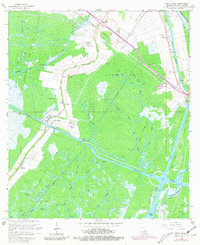
1966 Map of North Bend
USGS Topo · Published 1981About this map
Bayou Teche defines the northeastern boundary of this coastal St. Mary Parish landscape, where the legacy of plantation-era settlements meets the infrastructure of the mid-century energy boom. The transition from industrial agriculture to resource extraction is visible through the Southern Pacific rail line and the numerous Gas Wells scattered across the Garden City Field. Cultural history is anchored by family and community landmarks such as Little Zion Ch and several small burial grounds, including the Shadyside-Fairfax Cem and Gratt Cem.
Find a feature on this map
56 named features on this map. Tap any name to fly to it.
Don’t see what you’re looking for? This feature index may not catch every label — zoom into the map to look around manually.
Map Details
Editions of this 1966 North Bend Map
3 editions found
Other maps of this area

1935 · Belle Isle
USGS Topo · 1:31,680

1937 · Bayou Sale
USGS Topo · 1:62,500

1937 · Jeanerette
USGS Topo · 1:62,500

1941 · Belle Isle
USGS Topo · 1:62,500

1945 · New Orleans
USGS Topo · 1:250,000

1948 · Foster
USGS Topo · 1:62,500

1954 · Jeanerette
USGS Topo · 1:62,500

1954 · Belle Isle
USGS Topo · 1:62,500

1957 · Bayou Sale
USGS Topo · 1:62,500

1959 · Foster
USGS Topo · 1:62,500