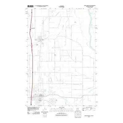
2010 Map of North Branch
USGS Topo · Published 2010About this map
North Branch and Harris anchor this Chisago County landscape during a period of steady residential expansion in eastern Minnesota. The settlement pattern is defined by a grid of rural roads like Sunrise RD and Keystone Ave, which connect small clusters of development to the primary north-south transit corridor. The local history is preserved in several burial grounds, including the Old Harris Cemetery, Mission Covenant Cemetery, and Green Acres Cemetery, reflecting the community's ancestral roots.
Find a feature on this map
58 named features on this map. Tap any name to fly to it.
Don’t see what you’re looking for? This feature index may not catch every label — zoom into the map to look around manually.
Map Details
Editions of this 2010 North Branch Map
This is the sole edition of this map. No revisions or reprints were ever made.
Other maps of this area

1950 · Rush City
USGS Topo · 1:48,000

1953 · Stillwater
USGS Topo · 1:250,000

1955 · Rush City
USGS Topo · 1:62,500

1955 · Forest Lake
USGS Topo · 1:62,500

1955 · Isanti
USGS Topo · 1:62,500

1955 · Stillwater
USGS Topo · 1:250,000

1958 · Stillwater
USGS Topo · 1:250,000

1961 · Cambridge
USGS Topo · 1:62,500

1965 · Stillwater
USGS Topo · 1:250,000
1974 · Stacy
USGS Topo · 1:24,000