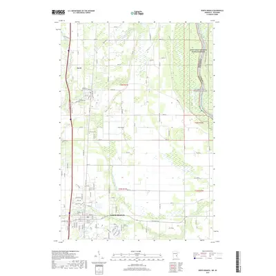
2019 Map of North Branch
USGS Topo · Published 2019About this map
North Branch and the village of Harris anchor this landscape along the upper reaches of the St. Croix Wild and Scenic River. The map reveals a high density of rural religious and funerary sites, including the Lutheran Church Cem, Mission Covenant Cem, and Trinity Lutheran Cem, which speak to the area's ancestral settlement patterns. The terrain is defined by a complex network of waterways and drainage systems, such as County Ditch Number Nine and County Ditch Number Three, which transformed the low-lying wetlands between Pine Island and the N Br Sunrise River into a managed agricultural grid. The eastern border is dominated by the Saint Croix National Scenic Riverway, marking the state line between Minnesota and Wisconsin.
Find a feature on this map
112 named features on this map. Tap any name to fly to it.
Don’t see what you’re looking for? This feature index may not catch every label — zoom into the map to look around manually.
Map Details
Editions of this 2019 North Branch Map
This is the sole edition of this map. No revisions or reprints were ever made.
Other maps of this area

1950 · Rush City
USGS Topo · 1:48,000

1953 · Stillwater
USGS Topo · 1:250,000

1955 · Rush City
USGS Topo · 1:62,500

1955 · Forest Lake
USGS Topo · 1:62,500

1955 · Isanti
USGS Topo · 1:62,500

1955 · Stillwater
USGS Topo · 1:250,000

1958 · Stillwater
USGS Topo · 1:250,000

1961 · Cambridge
USGS Topo · 1:62,500

1965 · Stillwater
USGS Topo · 1:250,000
1974 · Stacy
USGS Topo · 1:24,000