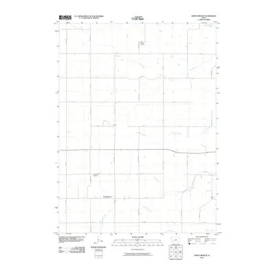
2010 Map of North Branch
USGS Topo · Published 2010About this map
North Branch and the small settlement of Nelson occupy a landscape defined by an intricate network of waterways in Guthrie County. The area is drained by numerous streams including Frost Creek, Lone Grove Creek, and Seely Creek, which flow through the agricultural grid. To the north, the South Raccoon River cuts across the corner of the township, while Troublesome Creek and Mason Creek anchor the southern reaches. This 2010 survey illustrates the persistent rural character of the region, where a rigid network of county roads like Cherry Ave and Dogwood Ave provides access to scattered farmsteads and historic burial sites. Genealogists may find value in the locations of Union Township Cemetery and Pleasant Hill Cemetery, which serve as quiet landmarks among the fields. The map also identifies Bear Grove, reflecting the township's long-standing geographic identities within this part of Iowa.
Find a feature on this map
30 named features on this map. Tap any name to fly to it.
Don’t see what you’re looking for? This feature index may not catch every label — zoom into the map to look around manually.
Map Details
Editions of this 2010 North Branch Map
This is the sole edition of this map. No revisions or reprints were ever made.
Other maps of this area

1954 · Omaha
USGS Topo · 1:250,000

1957 · Omaha
USGS Topo · 1:250,000

1957 · Audubon
USGS Topo · 1:62,500

1958 · Omaha
USGS Topo · 1:250,000

1971 · Coon Rapids South
USGS Topo · 1:24,000

1971 · Viola Center
USGS Topo · 1:24,000

1971 · Bayard
USGS Topo · 1:24,000

1971 · North Branch
USGS Topo · 1:24,000

1971 · Casey
USGS Topo · 1:24,000

1971 · Guthrie Center West
USGS Topo · 1:24,000