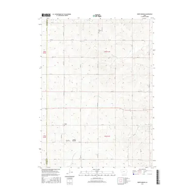
2015 Map of North Branch
USGS Topo · Published 2015About this map
The settlement of North Branch serves as a central landmark in this portion of Seely Township, where the agricultural landscape is defined by a grid of rural routes such as Chestnut Rd and Dogwood Ave. This 2015 survey reveals a terrain deeply carved by a network of waterways, including the distinct courses of Frost Cr and Troublesome Cr. Genealogists will find significant value in the location of several well-preserved burial grounds, notably Bear Grove Township Cem and Pleasant Hill Cem, which anchor the local history of the surrounding farmsteads. The map also delineates the western boundary shared by Audubon and Guthrie counties, highlighting the jurisdictional lines that have shaped land ownership in this region of Iowa for generations.
Find a feature on this map
38 named features on this map. Tap any name to fly to it.
Don’t see what you’re looking for? This feature index may not catch every label — zoom into the map to look around manually.
Map Details
Editions of this 2015 North Branch Map
This is the sole edition of this map. No revisions or reprints were ever made.
Other maps of this area

1954 · Omaha
USGS Topo · 1:250,000

1957 · Omaha
USGS Topo · 1:250,000

1957 · Audubon
USGS Topo · 1:62,500

1958 · Omaha
USGS Topo · 1:250,000

1971 · Coon Rapids South
USGS Topo · 1:24,000

1971 · Viola Center
USGS Topo · 1:24,000

1971 · Bayard
USGS Topo · 1:24,000

1971 · North Branch
USGS Topo · 1:24,000

1971 · Casey
USGS Topo · 1:24,000

1971 · Guthrie Center West
USGS Topo · 1:24,000