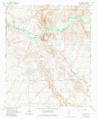
1964 Map of North Butte
USGS Topo · Published 1985About this map
The Gila River cuts through this arid landscape, flanked by the prominent landmarks of North Butte and South Butte. This mid-century survey reveals the industrial and transport infrastructure essential to the region, including the Southern Pacific railroad line following the river's northern bank. Significant engineering and historical sites are visible along the corridor, such as the Ashurst-Hayden Dam and the historical Coke Ovens located near the river bend. Small settlements and points of interest like Cochran and Price dot the rail line, while the Donnelly Ranch sits further south along the Donnelly Wash. The network of Jeep Trails and drainage patterns like Martinez Canyon and Box O Wash illustrate the complex topography of Pinal County, where water management and mineral processing once dictated the layout of local outposts.
Find a feature on this map
17 named features on this map. Tap any name to fly to it.
Don’t see what you’re looking for? This feature index may not catch every label — zoom into the map to look around manually.
Map Details
Editions of this 1964 North Butte Map
3 editions found
Other maps of this area

1900 · Florence
USGS Topo · 1:125,000

1902 · Florence
USGS Topo · 1:125,000

1922 · Red Rock No 2
USGS Topo · 1:48,000

1934 · Newman Peak
USGS Topo · 1:125,000

1954 · Mesa
USGS Topo · 1:250,000

1956 · Tucson
USGS Topo · 1:250,000

1957 · Mesa
USGS Topo · 1:250,000

1958 · Mesa
USGS Topo · 1:250,000

1958 · Tucson
USGS Topo · 1:250,000

1959 · Tucson
USGS Topo · 1:250,000