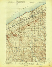
1915 Map of North East
USGS Topo · Published 1945About this map
Lake Erie defines the northern reaches of this coastal landscape, where the shoreline is carved by numerous parallel waterways including Eightmile Creek, Sevenmile Creek, and Twelvemile Creek. The village of North East serves as a significant hub for a network of transportation that follows the lake's curve, featuring the Erie RR, the Lake Shore and Michigan Southern RR, and the New York Chicago and St Louis RR.
Find a feature on this map
95 named features on this map. Tap any name to fly to it.
Don’t see what you’re looking for? This feature index may not catch every label — zoom into the map to look around manually.
Map Details
Editions of this 1915 North East Map
5 editions found
Other maps of this area

1899 · Westfield
USGS Topo · 1:62,500

1899 · Erie
USGS Topo · 1:62,500

1900 · Erie
USGS Topo · 1:62,500

1905 · Clymer
USGS Topo · 1:62,500

1913 · North East
USGS Topo · 1:62,500

1915 · North East
USGS Topo · 1:62,500

1923 · Cambridge Springs
USGS Topo · 1:62,500

1925 · Cambridge Springs
USGS Topo · 1:62,500

1929 · Corry
USGS Topo · 1:48,000

1929 · Union City
USGS Topo · 1:62,500