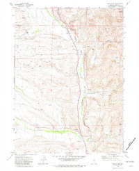
1971 Map of North Fork
USGS Topo · Published 1982About this map
The North Fork Humboldt River carves a critical corridor through this high-desert landscape, serving as the primary anchor for local ranching operations in the early 1970s. The settlement pattern is defined by family-named holdings positioned near water sources, including the Bellinger Ranch, Laing Ranch, and Truett Ranch. These locations represent the enduring agricultural legacy of Elko County, where access to the river and its tributaries like Pratt Creek and Foreman Creek dictated the placement of homesteads.
Find a feature on this map
23 named features on this map. Tap any name to fly to it.
Don’t see what you’re looking for? This feature index may not catch every label — zoom into the map to look around manually.
Map Details
Editions of this 1971 North Fork Map
2 editions found
Other maps of this area

1935 · Charleston
USGS Topo · 1:48,000

1942 · Mt. Velma
USGS Topo · 1:62,500

1955 · Wells
USGS Topo · 1:250,000

1956 · Wild Horse
USGS Topo · 1:62,500

1958 · Wells
USGS Topo · 1:250,000

1961 · Wells
USGS Topo · 1:250,000

1971 · Mahala Creek West
USGS Topo · 1:24,000

1971 · Double Mtn
USGS Topo · 1:24,000

1971 · North Fork
USGS Topo · 1:24,000

1971 · California Mtn.
USGS Topo · 1:24,000