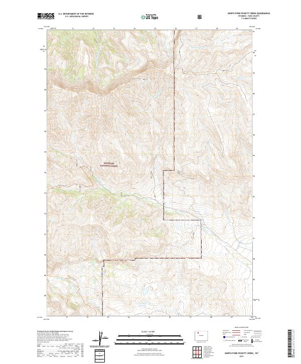
2021 Map of North Fork Pickett Creek
USGS Topo · Published 2021About this map
Shoshone National Forest defines the high-altitude landscape of this Wyoming terrain, where the massive profile of Carter Mtn dominates the northern horizon. The hydrology of the region is characterized by a series of descending drainages, including Middle Fork Rock Cr, Meeteetse Cr, and N Fork Pickett Cr, which carve through the slopes as they flow toward the east. The presence of the Big Piney Reservoir in the southern reaches suggests a localized management of water resources within this high-country environment. Navigation through this remote area is primarily facilitated by the Piney Creek Trl, which tracks the course of Piney Cr. This map documents a wilderness landscape largely shaped by its steep relief and protected status, with few permanent improvements beyond the established trail network and basic water infrastructure.
Find a feature on this map
18 named features on this map. Tap any name to fly to it.
Don’t see what you’re looking for? This feature index may not catch every label — zoom into the map to look around manually.
Map Details
Editions of this 2021 North Fork Pickett Creek Map
This is the sole edition of this map. No revisions or reprints were ever made.
Other maps of this area

1955 · Cody
USGS Topo · 1:250,000

1957 · Wapiti
USGS Topo · 1:62,500

1957 · Devils Tooth
USGS Topo · 1:62,500

1957 · Irish Rock
USGS Topo · 1:62,500

1957 · Sunshine Reservoir
USGS Topo · 1:62,500

1958 · Cody
USGS Topo · 1:250,000

1962 · Cody
USGS Topo · 1:250,000

1980 · Carter Mountain
USGS Topo · 1:100,000
1987 · Devils Tooth
USGS Topo · 1:24,000
1987 · Pitchfork
USGS Topo · 1:24,000