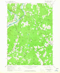
1959 Map of North Hartland
USGS Topo · Published 1965About this map
The Connecticut River serves as the focal point of this landscape, defining the boundary between Vermont and New Hampshire as it winds past Burnaps Island. Along the western bank, the Central Vermont RR tracks parallel the water, connecting settlements like North Hartland (Evarts Sta) and Russtown. Significant 20th-century engineering is evident at the North Hartland Dam on the Ottauquechee River, which created a controlled inundation area affecting the surrounding hills.
Find a feature on this map
106 named features on this map. Tap any name to fly to it.
Don’t see what you’re looking for? This feature index may not catch every label — zoom into the map to look around manually.
Map Details
Editions of this 1959 North Hartland Map
4 editions found
Other maps of this area

1902 · Sunapee
USGS Topo · 1:62,500

1905 · Sunapee
USGS Topo · 1:62,500

1906 · Hanover
USGS Topo · 1:62,500

1907 · Sunapee
USGS Topo · 1:62,500

1908 · Hanover
USGS Topo · 1:62,500

1926 · Claremont
USGS Topo · 1:62,500

1927 · Mascoma
USGS Topo · 1:62,500

1929 · Claremont
USGS Topo · 1:62,500

1932 · Mascoma
USGS Topo · 1:62,500

1950 · Glens Falls
USGS Topo · 1:250,000