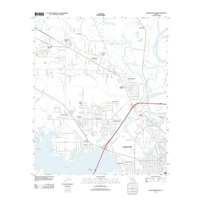
2012 Map of North Highlands
USGS Topo · Published 2012About this map
Cross Lake and its intricate shoreline of pockets and arms define the southwestern corner of this survey, where residential developments like Lakeview and Lakeside Acres meet the water at Willow Point. The landscape is a complex transition from the urban density of Shreveport to the north, crossing the industrial and resource-rich corridors of the Shreveport Oil Field and the Sentell Oil and Gas Field. Major transport and educational hubs anchor the area, including the Shreveport Downtown Airport and Southern University Shreveport.
Find a feature on this map
112 named features on this map. Tap any name to fly to it.
Don’t see what you’re looking for? This feature index may not catch every label — zoom into the map to look around manually.
Map Details
Editions of this 2012 North Highlands Map
This is the sole edition of this map. No revisions or reprints were ever made.
Other maps of this area

1932 · Bossier SW
USGS Topo · 1:31,680

1932 · Shreveport SE
USGS Topo · 1:31,680

1932 · Bossier NW
USGS Topo · 1:31,680

1932 · Shreveport NE
USGS Topo · 1:31,680

1941 · Forbing
USGS Topo · 1:31,680

1945 · Greenwood
USGS Topo · 1:62,500

1948 · Mooringsport
USGS Topo · 1:62,500

1948 · Bossier City
USGS Topo · 1:62,500

1948 · Caspiana
USGS Topo · 1:62,500

1955 · Shreveport
USGS Topo · 1:250,000