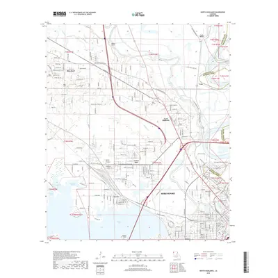
2018 Map of North Highlands
USGS Topo · Published 2018About this map
Twelvemile Bayou and the Red River define the eastern reach of this landscape, where the urban expansion of Shreveport meets the suburban and rural edges of Caddo Parish. The map reveals the intricate residential patterns of North Highlands and the established footprint of the Southern Univ at Shreveport campus. To the west, the waters of Cross Lake and its northern inlets, including Ben Roberts Pocket and Hicks Pocket, shape the local topography. This 2018 survey documents a mix of community landmarks, from the historic Oakland Cem to the modern operations at the Shreveport Downtown Airport. Small settlements like Blanchard and Lakeview illustrate the transition from the city center to the upland bluffs and bayous of the Red River Valley.
Find a feature on this map
211 named features on this map. Tap any name to fly to it.
Don’t see what you’re looking for? This feature index may not catch every label — zoom into the map to look around manually.
Map Details
Editions of this 2018 North Highlands Map
This is the sole edition of this map. No revisions or reprints were ever made.
Other maps of this area

1932 · Bossier SW
USGS Topo · 1:31,680

1932 · Shreveport SE
USGS Topo · 1:31,680

1932 · Bossier NW
USGS Topo · 1:31,680

1932 · Shreveport NE
USGS Topo · 1:31,680

1941 · Forbing
USGS Topo · 1:31,680

1945 · Greenwood
USGS Topo · 1:62,500

1948 · Mooringsport
USGS Topo · 1:62,500

1948 · Bossier City
USGS Topo · 1:62,500

1948 · Caspiana
USGS Topo · 1:62,500

1955 · Shreveport
USGS Topo · 1:250,000