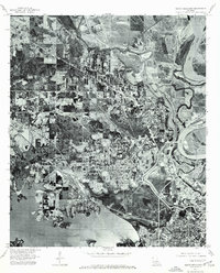
1975 Map of North Highlands
USGS Topo · Published 1976About this map
North Highlands and the northern reaches of Shreveport dominate this mid-1970s orthophotograph, providing a rare visual perspective on the urban-rural interface during a period of significant growth. The map captures the distinct topography formed by the winding Red River and the sprawling waters of Cross Lake, illustrating how the natural hydrology shaped the development of Louisiana's Caddo Parish. The intricate drainage of Twelvemile Bayou weaves through the landscape, revealing the complex floodplain patterns that guided residential and industrial expansion. Unlike traditional topographic maps, this orthophoto sheet uses actual aerial imagery to show the physical density of the forest, the exact footprint of suburban neighborhoods, and the network of roads and rail corridors as they existed just before the late 20th-century boom.
Find a feature on this map
5 named features on this map. Tap any name to fly to it.
Don’t see what you’re looking for? This feature index may not catch every label — zoom into the map to look around manually.
Map Details
Editions of this 1975 North Highlands Map
This is the sole edition of this map. No revisions or reprints were ever made.
Other maps of this area

1932 · Bossier SW
USGS Topo · 1:31,680

1932 · Shreveport SE
USGS Topo · 1:31,680

1932 · Bossier NW
USGS Topo · 1:31,680

1932 · Shreveport NE
USGS Topo · 1:31,680

1941 · Forbing
USGS Topo · 1:31,680

1945 · Greenwood
USGS Topo · 1:62,500

1948 · Mooringsport
USGS Topo · 1:62,500

1948 · Bossier City
USGS Topo · 1:62,500

1948 · Caspiana
USGS Topo · 1:62,500

1955 · Shreveport
USGS Topo · 1:250,000