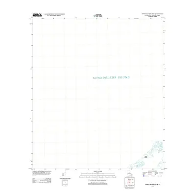
2012 Map of North Islands OE W
USGS Topo · Published 2012About this map
North Islands sit at the lower reaches of this coastal quadrangle, marking a narrow, shifting boundary between the open Gulf and the protected waters of Chandeleur Sound. This 2012 survey by the U.S. Geological Survey reveals the sparse, fragmented nature of this outer island chain in Saint Bernard Parish. The vast majority of the map is dominated by the open expanse of the sound, illustrating a landscape defined by isolation and maritime proximity rather than human infrastructure or inland terrain.
Find a feature on this map
2 named features on this map. Tap any name to fly to it.
Don’t see what you’re looking for? This feature index may not catch every label — zoom into the map to look around manually.
Map Details
Editions of this 2012 North Islands OE W Map
This is the sole edition of this map. No revisions or reprints were ever made.
Other maps of this area

1893 · Cat Island
USGS Topo · 1:62,500

1893 · Chandeleur
USGS Topo · 1:62,500

1951 · North Islands
USGS Topo · 1:24,000

1951 · New Harbor Islands
USGS Topo · 1:24,000
1951 · Freemason Island
USGS Topo · 1:24,000

1951 · Chandeleur Light
USGS Topo · 1:24,000

1953 · Mobile
USGS Topo · 1:250,000

1957 · Mobile
USGS Topo · 1:250,000

1957 · Breton Sound
USGS Topo · 1:250,000

1960 · Mobile
USGS Topo · 1:250,000