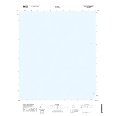
2020 Map of North Islands OE W
USGS Topo · Published 2020About this map
Chandeleur Sound dominates this coastal landscape in Saint Bernard Parish, representing a dynamic environment of shifting barrier island remnants. The map focuses on a largely maritime expanse where the North Islands appear as small, isolated features in the southeastern corner. This area, documented by the U.S. Geological Survey in 2020, illustrates the fragile nature of Louisiana's outer shoreline. Without the presence of permanent human settlements or infrastructure, the map serves as a primary record of natural landforms within the sound. It is an essential reference for understanding the geography of the Mississippi River Delta's eastern perimeter during the early twenty-first century.
Find a feature on this map
2 named features on this map. Tap any name to fly to it.
Don’t see what you’re looking for? This feature index may not catch every label — zoom into the map to look around manually.
Map Details
Editions of this 2020 North Islands OE W Map
This is the sole edition of this map. No revisions or reprints were ever made.
Other maps of this area

1893 · Cat Island
USGS Topo · 1:62,500

1893 · Chandeleur
USGS Topo · 1:62,500

1951 · North Islands
USGS Topo · 1:24,000

1951 · New Harbor Islands
USGS Topo · 1:24,000
1951 · Freemason Island
USGS Topo · 1:24,000

1951 · Chandeleur Light
USGS Topo · 1:24,000

1953 · Mobile
USGS Topo · 1:250,000

1957 · Mobile
USGS Topo · 1:250,000

1957 · Breton Sound
USGS Topo · 1:250,000

1960 · Mobile
USGS Topo · 1:250,000