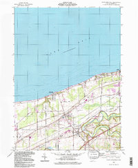
1994 Map of North Kingsville
USGS Topo · Published 1997About this map
Lake Erie defines the northern edge of this Ohio shoreline survey, where the bluffs transition into the fertile plains of the Connecticut Western Reserve. The landscape is marked by a mix of summer recreation and industrial history, from the shoreline retreats of Kingsville On-the-Lake and Camp Calvary to the heavy infrastructure of the Conrail line. Inland, the deep meanders of Conneaut Creek cut through the terrain, creating the distinct topography near Lulu Falls Cem and the village of Kingsville.
Find a feature on this map
39 named features on this map. Tap any name to fly to it.
Don’t see what you’re looking for? This feature index may not catch every label — zoom into the map to look around manually.
Map Details
Editions of this 1994 North Kingsville Map
This is the sole edition of this map. No revisions or reprints were ever made.
Other maps of this area

1905 · Ashtabula
USGS Topo · 1:62,500

1906 · Conneaut
USGS Topo · 1:62,500

1950 · Cleveland
USGS Topo · 1:250,000

1950 · Erie
USGS Topo · 1:250,000

1956 · Cleveland
USGS Topo · 1:250,000

1959 · Erie
USGS Topo · 1:250,000
1960 · North Kingsville
USGS Topo · 1:24,000
1960 · Gageville
USGS Topo · 1:24,000

1960 · Ashtabula South
USGS Topo · 1:24,000
1960 · Ashtabula North
USGS Topo · 1:24,000