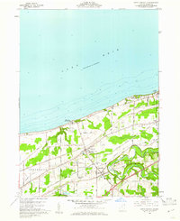
1960 Map of North Kingsville
USGS Topo · Published 1961About this map
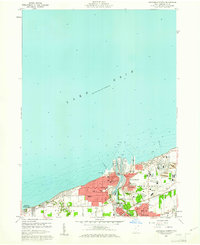
Lake Erie defines the northern edge of this 1960 survey, where the shoreline is dotted with summer-oriented features like Kingsville On-the-Lake, Camp Luther, and Camp Calvary. Further inland, the settlement pattern of North Kingsville and Kingsville is deeply influenced by the parallel transit corridors of the New York Central Line and the Chicago and St Louis Line. These railroads, alongside major thoroughfares like South Ridge Road, bypass the winding oxbows of Conneaut Creek to the south. Local landmarks such as the Drive-in Theater and Gardner Airpark reflect the post-war expansion of recreation and private aviation in Ashtabula County. Genealogists may find particular interest in the mapped locations of the County Home and several local burial grounds, including Lake Road Cem and Lulu Falls Cem.
Find a feature on this map
37 named features on this map. Tap any name to fly to it.
Don’t see what you’re looking for? This feature index may not catch every label — zoom into the map to look around manually.
Map Details
Editions of this 1960 North Kingsville Map
Other maps of this area

1905 · Ashtabula
USGS Topo · 1:62,500

1906 · Conneaut
USGS Topo · 1:62,500

1950 · Cleveland
USGS Topo · 1:250,000

1950 · Erie
USGS Topo · 1:250,000

1956 · Cleveland
USGS Topo · 1:250,000

1959 · Erie
USGS Topo · 1:250,000
1960 · Gageville
USGS Topo · 1:24,000

1960 · Ashtabula South
USGS Topo · 1:24,000
1960 · Ashtabula North
USGS Topo · 1:24,000
1960 · Pierpont
USGS Topo · 1:24,000