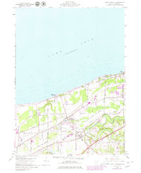
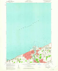
1960 Map of North Kingsville
USGS Topo · Published 1980About this map
Lake Erie defines the northern edge of this coastal survey, where the shoreline of Kingsville and North Kingsville meets the industrial and transport corridors of northeastern Ohio. The landscape is a mix of recreational and utility sites, featuring Kingsville On-the-Lake and the grounds of Camp Luther and Camp Calvary alongside the Ashtabula-Conneaut Airport. Transportation history is well-represented by the parallel tracks of Conrail and the Norfolk and Western railroads, which cut through a terrain marked by small cemeteries like Lake Road Cem and East Lake Cem.
Find a feature on this map
37 named features on this map. Tap any name to fly to it.
Don’t see what you’re looking for? This feature index may not catch every label — zoom into the map to look around manually.
Map Details
Editions of this 1960 North Kingsville Map
Other maps of this area

1905 · Ashtabula
USGS Topo · 1:62,500

1906 · Conneaut
USGS Topo · 1:62,500

1950 · Cleveland
USGS Topo · 1:250,000

1950 · Erie
USGS Topo · 1:250,000

1956 · Cleveland
USGS Topo · 1:250,000

1959 · Erie
USGS Topo · 1:250,000
1960 · North Kingsville
USGS Topo · 1:24,000
1960 · Gageville
USGS Topo · 1:24,000

1960 · Ashtabula South
USGS Topo · 1:24,000
1960 · Ashtabula North
USGS Topo · 1:24,000