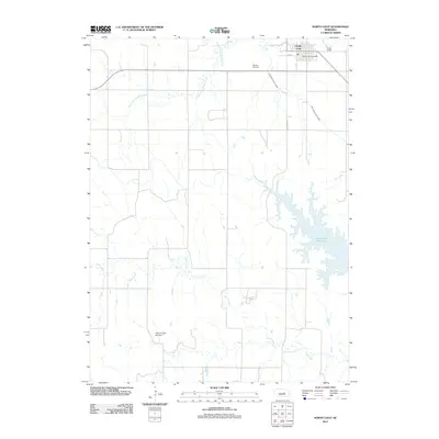
2011 Map of North Loup
USGS Topo · Published 2011About this map
North Loup serves as the primary hub of this Valley County landscape, where the town's grid is anchored by the North Loup Post Office and bordered by the winding path of Mira Creek. The map documents a sophisticated irrigation and water management system essential to the region's agricultural character, featuring the extensive Ord North Loup Canal which cuts across the terrain. To the southeast, the substantial Davis Creek Reservoir dominates the drainage of Davis Creek, reflecting 21st-century water storage infrastructure. Local history is etched into the land at the Hillside Cemetery and the specific site of Hickman Dam Number 1. The terrain is defined by the dendritic patterns of the North Branch Mira Creek and South Branch Mira Creek, showing the natural watercourses that shaped early settlement patterns before modern engineering introduced the canal systems.
Find a feature on this map
12 named features on this map. Tap any name to fly to it.
Don’t see what you’re looking for? This feature index may not catch every label — zoom into the map to look around manually.
Map Details
Editions of this 2011 North Loup Map
This is the sole edition of this map. No revisions or reprints were ever made.
Other maps of this area

1899 · Loup
USGS Topo · 1:125,000

1953 · Loup City NW
USGS Topo · 1:24,000

1953 · Cotesfield
USGS Topo · 1:24,000

1953 · North Loup
USGS Topo · 1:24,000

1953 · Scotia
USGS Topo · 1:24,000

1953 · Loup City SE
USGS Topo · 1:24,000

1953 · Loup City
USGS Topo · 1:24,000

1954 · Ord SE
USGS Topo · 1:24,000

1954 · Ord
USGS Topo · 1:24,000

1954 · Horace
USGS Topo · 1:24,000